Sign up for the newsletter
Explore Gravel bike
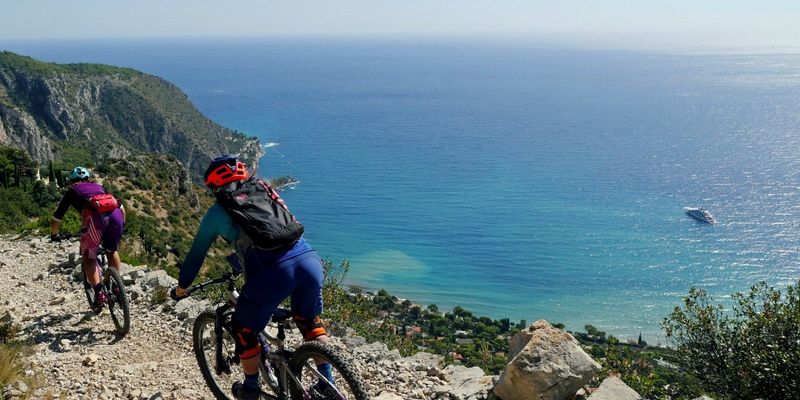
Gravel ruines de Chateauneuf
Routes
Very low slope <5% %
Low slope <7% %
Moderate slope <10% %
Steep slope <15% %
Very steep slope >15% %
Description
Discover Mont Macaron by the side of the Paillon valley. From the village located on the road of the Col de Châteauneuf, which overlooks the Paillon valley, the circuit invites you to descend by the Metropolitan road not very busy until Contes and then to the starting point of the Gravel. From this place called la Bégude, the Ciauric and Mont Macaron tracks will join the aerial ridge of Mont Macaron (806 m) which tapers towards the South, In the end, an exhaustive discovery of the old county of Nice whose villages punctuate valleys and hills around the Azure capital. Perched at 750 meters on a strategic eminence, St.Joseph’s Chapel first and the ruins of Châteauneuf then, will announce the pass (625 m) and the return to the starting point below.
Photos